Lost or Need Guidance – GPS-based Digital For Navigation apps
GPS: Focuses on location and navigation only.
Need Guidance? Use GPS-based digital mapping and navigation hiking apps, several features and optimizations can be introduced to enhance user experience, safety, and functionality. Here’s a detailed breakdown of how these apps can be enhanced:
1. Offline Navigation & Enhanced Maps
- Offline Map Support: Ensure that maps and essential navigation features are available offline. Users should be able to pre-download maps of specific hiking regions in high detail.
- 3D Topographical Maps: Introduce 3D maps with accurate elevation and terrain data for better understanding of landscapes.
- High-Resolution Satellite View: Offer high-resolution satellite maps that provide detailed visuals of trails, vegetation, and landmarks.
- Custom Map Layers: Allow users to overlay different types of data on the map, such as weather patterns, trail difficulty, or even historical landmarks.
2. Route Planning & Recommendations
- Smart Route Suggestions: Based on user preferences (difficulty, distance, elevation gain), the app could suggest optimized routes or alternatives, especially if the primary trail is crowded or unsafe.
- AI-Powered Route Adjustments: Utilize AI to recommend real-time route adjustments based on factors like weather changes, trail conditions, or personal performance.
- Crowdsourced Trail Information: Integrate real-time trail conditions and reviews contributed by other hikers, including photos and updates on obstacles, wildlife, or recent trail damage.
3. Safety & Emergency Features
- SOS Button & Emergency Alerts: Incorporate a one-click SOS button that automatically sends the user’s coordinates to emergency services and designated contacts.
- Hazard Detection: Use AI to detect potential dangers, such as steep drop-offs, avalanches, or river crossings, and issue alerts.
- Geofencing for Alerts: Create customizable geofences so users are alerted when they stray from their designated route or enter hazardous areas.
4. Advanced GPS Tracking & Live Sharing
- Real-time Location Sharing: Allow users to share their real-time location with family and friends, even with limited connectivity, using satellite-based messaging.
- Breadcrumb Trails: Implement a feature to automatically record and visualize your hiking trail, creating a “breadcrumb” path that can be followed back in case of confusion or emergency.
- Personalized Stats & Tracking: Track elevation gain, speed, and estimated calories burned, and give performance feedback based on the user’s previous hikes.
5. Augmented Reality (AR) & AI
- AR Trail Markers: Use augmented reality to place virtual markers on real-world objects (rocks, trees) to help guide users through unclear or unmarked paths.
- AR for Landmarks: Display information about nearby landmarks, points of interest, or scenic viewpoints through AR overlays.
- AI-Powered Photo Recognition: Incorporate AI that helps identify flora, fauna, or geological formations from photos uploaded by the user.
6. Weather & Environmental Updates
- Integrated Weather Forecasting: Real-time weather data and predictive modeling for the hiking area, with alerts for sudden changes like rain, storms, or temperature drops.
- Air Quality Monitoring: Provide up-to-date air quality information, particularly relevant in areas prone to wildfires or high-altitude hikes.
- Tide & River Levels: For coastal or river-based hikes, offer real-time data on tides, river levels, and crossing safety.
7. Community & Gamification
- Hiking Challenges & Leaderboards: Encourage users to participate in global or local hiking challenges, unlocking badges or rankings based on completed trails, elevations gained, or distance traveled.
- Hiking Logs & Journals: Let users maintain a personal hiking log with automatic tracking of stats, including distance, time, and elevation. Add journaling options with geotagged photos and notes.
- Social Media Sharing: Allow users to share their routes, photos, and accomplishments easily on social media platforms.
8. Battery & Resource Efficiency
- Power-Saving Modes: Implement low-power modes for extended trips, reducing battery usage by limiting GPS frequency or disabling non-essential features.
- Battery Estimation: Provide real-time estimates of battery life based on usage patterns and time remaining for planned trails.
9. Local Trail Information & Sustainability
- Local Regulations & Permits: Integrate up-to-date local regulations, park permits, or conservation rules that hikers should be aware of for their planned routes.
- Leave No Trace Guidance: Offer environmental tips and checklists to encourage sustainable hiking practices, ensuring minimal impact on the environment.
10. Accessibility & Inclusivity
- Trail Accessibility Filters: Provide filters for accessible trails suitable for people with disabilities or specific needs (e.g., wheelchair-friendly, low-elevation routes).
- Multi-language Support: Ensure the app supports multiple languages and provides local translation of place names and important notices.
11. Integration with Other Apps & Devices
- Wearable Integration: Ensure compatibility with popular wearable devices like Garmin, Apple Watch, or Fitbit for real-time updates, heart rate monitoring, and notifications.
- Companion App for Navigation Devices: Create companion apps for GPS devices, allowing seamless transfer of planned routes between devices.
Conclusion:
Improving GPS-based hiking apps means integrating cutting-edge technologies like AI, AR, and advanced mapping features while focusing on user experience, safety, and environmental sustainability. Incorporating these features will transform hiking into a more personalized, engaging, and safer activity for both casual and experienced hikers.
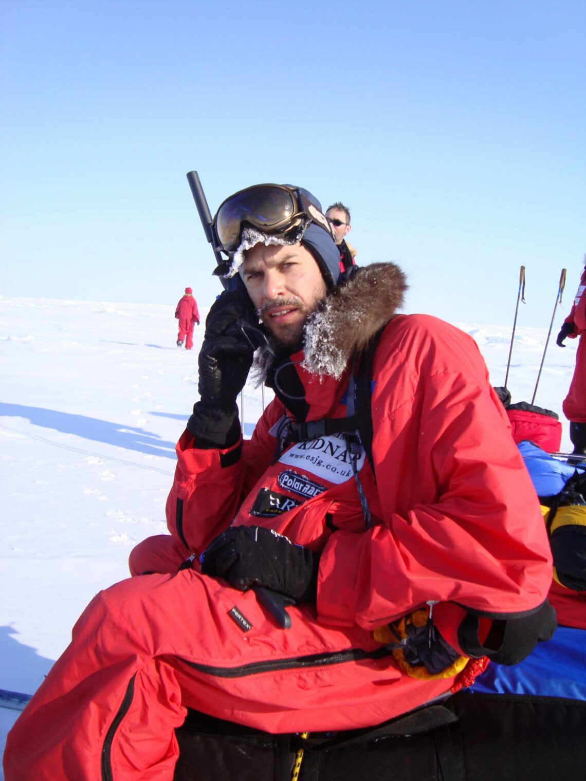
Satellite communicators are indispensable in emergency situations where GPS alone falls short. Their ability to provide two-way communication makes them essential tools for outdoor enthusiasts, rescue teams, and explorers in remote areas.
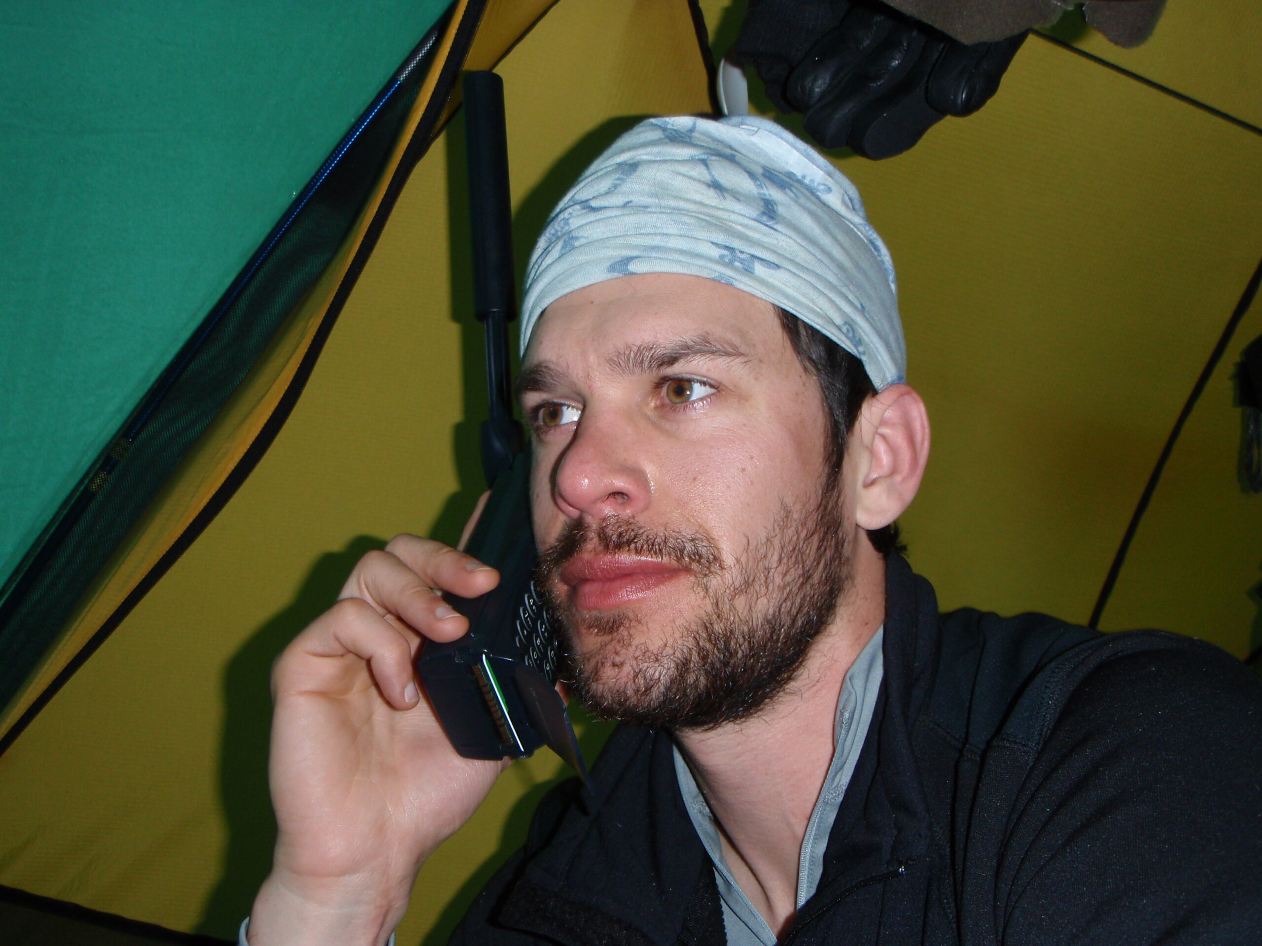
Devices like the Garmin InReach and SPOT take GPS technology a step further by integrating navigation and tracking with advanced communication features. These communicators are ideal for remote environments where reliable connectivity is critical. Beyond standard GPS functions, they offer two-way messaging, SOS emergency alerts, and real-time weather updates through satellite networks, ensuring users remain connected even in regions with no cellular coverage
**I am excited to share the captivating story of my extraordinary journey with you. Also my How-To Becoming a Fearless Adventurer
#livealifetodiefor #SussexCancerFund #LymphomaCancer #itsrogerx